

While Mount Everest may be the highest of the 8000-meter summits and Annapurna and K2 are considered the most dangerous, Kangchenjunga (also spelled as Kanchenjunga) remains one of the most remote and captivating of all of the Himalayan peaks and a trek to its north and south base camps should be on every trekker and wilderness lover’s bucket list.
My wife and I and several of our PCT “tramily” from a few years ago, plus some other avid trekking friends, set out this spring to do a circuit around the mountain. The trek isn’t exactly a circuit, as Kanchenjunga straddles India’s Sikkim and Nepal, and one cannot walk around the entire mountain due to border controls, but on the Nepal side, there is a route up to North Base Camp, then a slight backtrack and crossing of several high passes to reach the south side and up to South Base Camp, before heading down another valley and over some gorgeous Himalayan foothills to return to where one started.

Just getting to the start of the Kangchenjunga trek is an ordeal, as it either requires a 20-hour backbreaking bus ride across Nepal to the east, followed by several brutal jeep rides to get further into the mountains, or else a flight followed by the same jeep combinations. We sensibly opted to fly to Bhadrapur, out on the Terai plains, and then spend a couple of days driving up, passing through the lush tea plantations of Ilam before starting at the road’s end in Sekathum.
The effort needed to get to the trail has helped keep Kangchenjunga free from the massive crowds that now plague the Everest region and Annapurnas. During our three-week trek, we heard only one helicopter flying up to Base Camp. In the Everest area, one hears and sees probably at least ten per hour. Additionally, until several years ago, Kangchenjunga was not a teahouse trek, and required camping, porters, food, and pretty much a full-blown expedition to get to, whereas today one can find at least a few basic teahouses everywhere, spread within a day’s walk apart, meaning one can now carry a light pack, be well fed, and get to experience a side of trekking in Nepal that in other places has long disappeared.

In the more popular trekking areas of Nepal, kids are usually asking for either chocolates or money, but here, children and other villagers still come out in villages or on the trail and greet you with their hands folded in prayer, gently saying “Namaste,” and respectfully welcoming you. During the October high season, 800-odd trekkers made the journey to Kangchenjunga a year ago, while in the second most popular spring months, less than 150 visited. Contrast this with the 50,000 plus who annually make their way to see Everest Base Camp.
While October boasts the clearest weather, we opted for an April visit, not only to avoid the human numbers but to see the beautiful Himalayan rhododendron forests come to life, as April brings plenty of blossoms and color to the lower reaches. In this region, we also passed through tiny hamlets that were all busy growing lush swathes of large cardamom, as this part of Nepal produces 80% of the national crop, a big income maker, and second only to handmade carpets as the country’s top export.


As we started climbing from 2,000 to 3,000 meters, we were immediately rewarded with magical carpeted and mossy forests full of bright red, pink, and magenta blooms. This quickly gave way to pine forests as we climbed higher, with the subtropical air being replaced by crisp and dry breezes.

One passes through a phenomenal array of climatic zones on this trek, going from terraced rice fields in the Himalayan foothills, up into humid rhododendron forests, followed by dry pine, and eventually getting up above tree line into an arid high mountain desert, only this desert is surrounded by massive, glaciated peaks, vast moraine, and an endlessly moving and shifting landscape full of giant boulders, landslides, and extremely harsh terrain.
The Sherpas and Limbu people live in the higher reaches here, self-sufficient communities that subsist on potatoes, wheat, and further up, where almost nothing grows, barley. Millet is also an important crop here, and the fermented alcoholic tongba that is made from it, it is some of the best in Nepal. In contrast to the Everest region, only a few of the highest teahouses here are established solely for trekkers. Everywhere else is a traditional village where people have lived for ages.

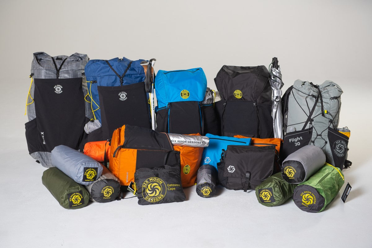
As we didn’t have to camp on this trek, my pack of choice as usual was my Six Moon Designs Wy’east daypack. I find this 30-liter pack to be really robust and perhaps their strongest and best-designed pack. I have actually taken it out on overnight camping trips, but it’s a bit tight when one starts adding the tent, stove, and all else, but for hut and teahouse trekking, day hiking, and all travel, it is optimal. It only weighs 25 oz, comes with a comfortable wing belt, has a huge outer pocket to put everything from rain gear to snacks to even jackets for cold days in, and for me, probably best of all is the bright orange color, which comes out in photographs!

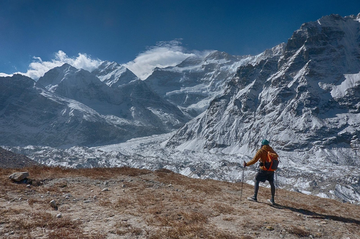
Kangchenjunga was originally thought to be the world’s highest mountain until 1852, and it actually isn’t just one prominent peak, but a massif of high peaks and different ridges that dominate the skyline. While the Okutang Viewpoint, just shy of South Base Camp, is fairly easy to reach, just an hour’s walk from the teahouses at Ramche, the 5140m (16,863 feet!) North Base Camp is far more of an ordeal, with a half day’s climb up and over landslides, glacial moraine, and a jumble of massive natural debris.
Similarly, the normal ascent route of the mountain, which was first climbed by a British team in 1955, goes from the south side, while the savage north route to the summit was not reached until 1979, and is rarely climbed.

North Base Camp was my defining moment of the trek. I was feeling well-acclimatized and fit that morning and was ahead of our team. The valley we were walking up seemed to go on forever, with Kangchenjunga hidden from view around the corner. The route follows the immense Kangchenjunga Glacier, an endless funnel of ice running almost all the way up the valley we’d come to, and then turning to climb up towards the fierce north ridge. The trail we were on officially ends at a spot known as Pangpema, where the entire Kangchenjunga massif is visible, along with a host of other Himalayan giants.

As I arrived here, several blue sheep plodded down from the hillside, completely oblivious to my presence as they grazed, not more than ten feet away from me. The silence here was absolutely deafening, everything completely still. I looked around and realized how far I was from civilization, and what a wild and savage place this was. I couldn’t help but think that if I were at Everest or Annapurna base camps, there would be hundreds of others, with plenty of noise and intrusion.

The walk down and back through the foothills, while not as wildly majestic, was still wonderful. We breathed more easily at lower elevations and were no longer subject to biting cold. We saw color again, marching through the misty forests and next to the giant rhododendrons. But even better were the villages here, many of which see very few trekkers. There weren’t even teahouses in places, rather just basic homestays, where the owners cooked us fresh vegetables from their gardens and tidied up a place in their home for us to sleep. While roads continue to be built into the mountains, for now, Kangchenjunga remains one of the world’s most unspoiled and ruggedly beautiful treks, well worth investing the effort to get to.
Leave a comment
This site is protected by hCaptcha and the hCaptcha Privacy Policy and Terms of Service apply.