

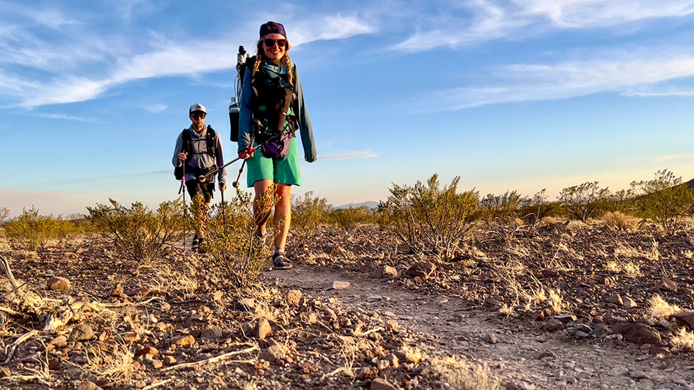


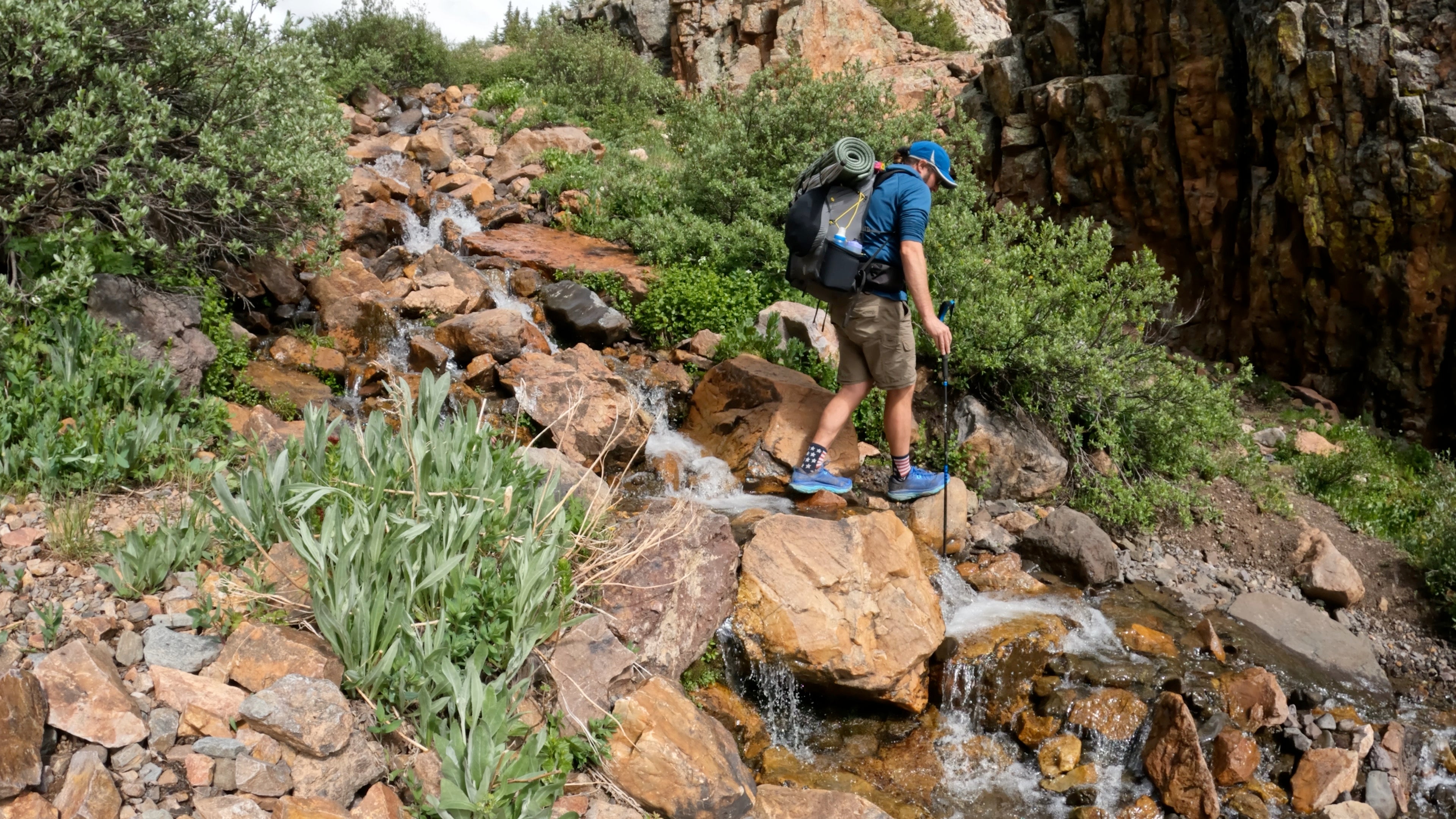
The author (left) and his friend "Tomato hiking along an old USFS road that is part of the C2C trail. photo by Naomi Hudetz
The Trail
The Corvallis 2 Coast Trail (C2C) is a 60-mile trail that connects the Willamette Valley to the Oregon Coast allowing users to see and experience the Oregon Coast Range. The trail has been a dream for almost 50 years, and thanks to the hard-work of volunteer and a strong grass-roots effort in the area the trail is now a reality.

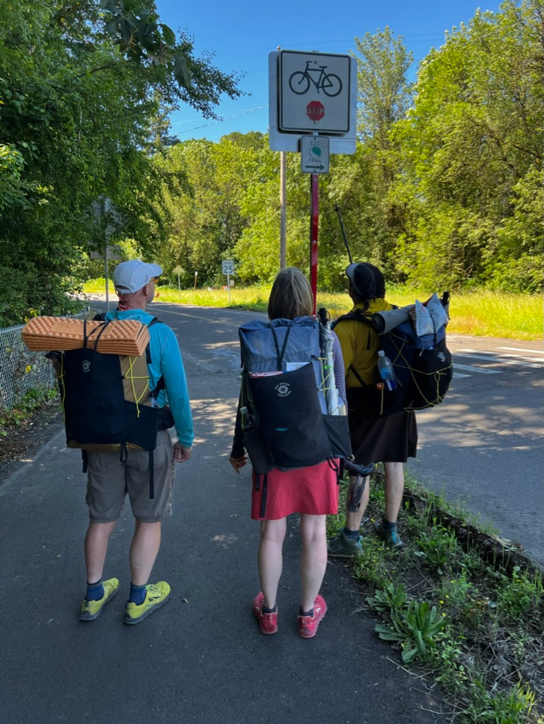
Setting out for a thru-hike of the C2C Trail. Photo by Mike Unger
This trail begins in downtown Corvallis, OR home of Oregon State University and pieces together bike paths, roads, old decommissioned USFS roads, and walking trails. The trail ends at Ona Beach State Park roughly 8 miles South of Newport, OR. Hikers can walk out onto the beach and put their feet in the Pacific. For hikers looking to extend their hike, the C2C connects into the Oregon Coast Trail which runs the entire length of Oregon’s Coast from the Mouth of Columbia to the California Border.
Besides being a hiking trail the C2C also has a dedicated Bike Routes that follow along the route and shares some of the trail with hikers and ten diverges onto back roads where bikes are not allowed.

Stopping for a cold drink in the park, the C2C does have a few 7-10 mile stretches between water sources. Photo by Whitney La Ruffa
Maps, Permits, and Access
Maps
The C2C website has free maps to download and a GPX track for those of you who prefer to navigate with an app like Gaia GPS. You can also purchase a map produced by the trail organization from their website or one of the various vendors listed on their site. We stopped in Corvallis on our recent hike to buy the paper map and it was very helpful along the way to identify water sources.
Permits
Hikers and Bikers will need to obtain a free permit to access the Starker Forests’ land that trail crosses. The permit is free and all you need to do to obtain it is call their office Mon-Fri between 7:30-4:30 PST, all the permit info can be found here.
Access
The trail has multiple trailheads that you can access along the way with a car, directions to parking and trail heads can be found on the trail’s website. In addition to accessing the trail by car, another option is to use public transportation. The Benton County Coast to Valley Express (NW Connector) is a great option to access the trail, if you’re interested in hiking the trail west bound you could hike to Ona Beach and then either hitch hike to Newport or use the Oregon Coast Trail to get up to Newport to catch the bus. If going East Bound you could park in Corvallis, ride the bus to Newport and then either hike to the start at Ona Beach or use a ride service from Newport to Ona Beach State Park. Fair warning there is no cell reception at Ona Beach

Tomato is trying to see if he can get a call out at the end for our ride to come get us....if you walk down to ocean you can get a faint signal Photo by Naomi Hudetz
Camping
One challenge along the route is legal camping, camping is only allowed on US Forest Service lands. To be very clear camping is not allowed on private property! This means you must time your hiking hours and mileage accordingly to avoid being stuck on private land at night fall. There are a few options for camping in a more designated area, such as the Philomath Grange Hall which can be contacted ahead time to arrange camping for $5 (Contact: Marysrivergrange.org, marysrivergrange@gmail.com, 541-829-2907)

The author enjoying some downtime after a long day in his Serenity Net Tent. Photo by Naomi Hudetz
There is also a USFS campsite in Harlan, which is located 1 mile off the hiking route. The USFS Big Elk Campground ha a designated hiker/biker campsite that cost $5 per person, other sites are available at the campground but are first come/first served.
Trip Report
I recently hiked the C2C trail with 3 friends, we had originally planned to hike this trail over the New Year’s Holiday, but the coast range received a big winter storm that dropped over 2 feet of snow making a thru-hike non-feasible. When our trip was canceled in January, we decided we would hike it this spring or summer, due to a late rainy season and other travel during the spring, our first chance to hike it was the last weekend of June. So, we threw it on our calendar and started making plans.

Walking along an old road bed just miles away form the beach. Photo by Whitney La Ruffa
The whole trip was almost canceled, I returned from Summer OR and a few days later came down with a nasty case of COVID, right as I was getting past my 10 days of isolation, we were scheduled to start the hike. Then after having one of the wettest springs in Oregon’s history, the weekend we were hiking was our first 3-day heat wave, it was as if the Coastal Gods were telling us to stay away…
Saturday came and we all met in Portland and drove down to the start in Corvallis. We stopped into the local Bike shop to grab a map of the hike and ask if they knew where we could leave a car. They suggested we find a place to park back in a neighborhood by houses to minimize the risk of a car break in. We found such a place, parked, and walked a few blocks to the start of the trail.
The first 8 miles or so are along the Corvallis Philomath bike path, this paved path is basically a flat bike trail that parallels the highway then takes you through some neighborhoods in Philomath. With our big 10:30am start time we arrived in Philomath right on time for lunch, since the temp was close to 90o we decided to restore our energy levels with a visit to Dairy Queen for some hot eats and cool treats. After gorging ourselves we threw on our packs and walked the final stretch of the bike path to where it turned to a paved road, and little bit later we were climbing up old roads towards Mary’s Peak. There is an option to climb the peak but it added 2 miles and over 2,000’ of elevations, so we stuck to the route and hiked along a series of gravel roads and trails.

Foxgloves were in full bloom along the hike, this with a variety of other wild flower in their peak bloom made for beautiful miles along the way. Photo by Whitney La Ruffa
Towards the end of the day, we experienced what would be the common issue on this trail, where are we going to camp? Given the steep terrain and thick brush finding a spot off the trail was difficult at best. On top of the terrain this trail also weaves it way through a variety of property ownerships, getting to legal USFS ground was going to make it a long day for sure. After 23 miles on our first day, we finally crossed the boundary for legal camping in USFS property. Given the late hour and limited options we camped right along the trail, which happened to be a decommissioned roadbed, it was flat, but getting a stake into the rocky ground was brutal.
Our second day was to be the hottest of the trip, we awoke to the sound of buzzing mosquitos, and quickly broke camp and got on the trail, hoping to make some miles before the heat got too bad. The trail this day was mainly on old dirt roads and decommissioned forest service roads. The trail climbed up and over some mountains and dropped us down along a valley through the hamlet of Harlan, which much to our dismay there was no store, gas station or even a soda machine for a cold drink. We instead filtered a ton of water to stay hydrated as the temps were about 95 degrees and humid with now breeze.

The Coast Range in Oregon is a temperate rainforest, and as a result has a plethora of lush vegetation. Photo by Whitney La Ruffa
We walked through the forest and through a lot of brush. The wet spring really has the underbrush growing like crazy this year. The miles stretched on as the day did, and after numerous encounters with stinging nettles the trail dropped us onto a USFS road that was open and allowed us to all walk as a group side by side. Camping again was the issue, the road was traversing a steep coastal mountain and the choice for making camp were pretty much zero to none. We eventually found a large pull out on the side of the road with an old fire pit most likely form a hunting camp in the fall, we again did all we could to pound in our stakes and set up camp for the night.
Our final day started off much cooler thanks to the onshore coastal breeze that came in during the night. We ate and packed up quickly to make the beach in time for our ride to come get us. As we walked our way to the coast the trail was pleasant and mostly on old dirt roads. There was an active logging operation going on about 5 miles from the end, so we used the bike route as the detour around it and walked our last miles on a lightly traveled paved road. With each mile towards the Pacific the air got cooler and had that smell of salt water. We eventually popped out at US 101 and did a quick dash across the highway to the end of the hike at Ona Beach Picnic Area. We headed down the boardwalk and into the ocean to wet our feet and complete or hike of the C2C.

The end of the trail, the MIghty Pacific Ocean- Photo by Mike Unger
Conclusion

Ona Beach is lovely long sandy beach in Oregon where the hike ends at the Western terminus. Photo by Naomi Hudetz
The C2C is a great trail for those looking for a shorter hike that connects a valley, a mountain range, and the ocean. While the camping along the way makes for some tougher logistics and longer miles, its shouldn’t be an issue for those who are willing to do either longer days or shorter days to accommodate the legal spots to camp. The trail is very well marked making navigation a breeze, and the community around the trail are supportive and excited about seeing users out on the trail. Finally, we have a way to connect the Willamette Valley with the Oregon Coast by foot or bike. Thanks to the temperate climate in this part of the state, I can see this hike becoming a staple of my shoulder season and winter hike rotation for many years to come.
Leave a comment
This site is protected by hCaptcha and the hCaptcha Privacy Policy and Terms of Service apply.