When you go backpacking during the July/August monsoon season in the San Juan mountains of Colorado you can expect rain and sometimes a lot of it like this summer, one of the top 5 wettest in history. It rained almost every day of this hike that began on June 23 at Cumbres Pass on the Continental Divide Trail (CDT) at the New Mexico/Colorado border. Ironically, Deb and I drove to Chama, NM the day before where we discovered the town in a state of emergency! The entire town was without water due to an undiscovered leak and the town’s holding tanks had run dry. In town our favorite motel, the Chama Trails Inn, was open but with portable bathrooms in the lot and serving bottled drinking water. We made do with deli food from the nearby grocery store as I organized my gear.
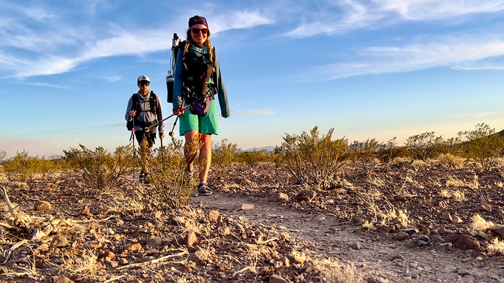
The next morning saw me setting out on the CDT northbound under dark and threatening skies on what I expected to be a 40-day, 450-mile hike. This was my annual adventure fundraiser for the foundation www.gohawkeye.org, that I co-founded, and helps people with disabilities get out and enjoy the benefits of outdoor recreation. Deb joined me for the first few miles before turning back when the wind came up and it started to rain. She will meet me next at Wolf Creek Pass in nine days. I entered the South San Juan Wilderness with a plan to fish some of the lakes as I made my way north. On the CDT at Trail Lake, I located the cairns of the Valle Victoria Trail which headed east, cross country with no tread, and following these occasional stacked rock piles in the distance across a high alpine rolling plateau. The trail was difficult to follow and the lakes I found on this 3-day side trip were shallow and non-productive. I did find some real trail occasionally, but it would fade out and I would have to bushwack by map and compass.

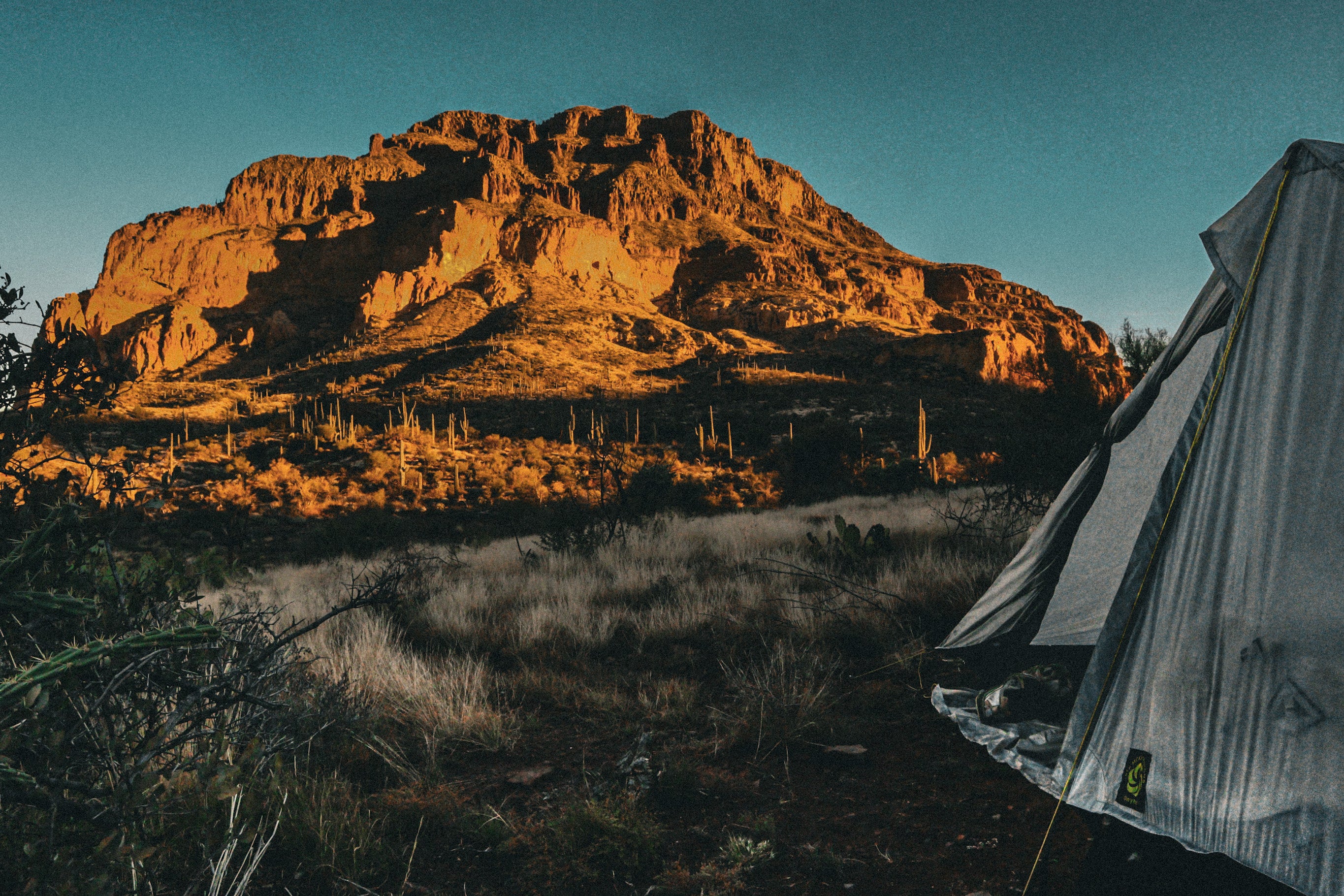
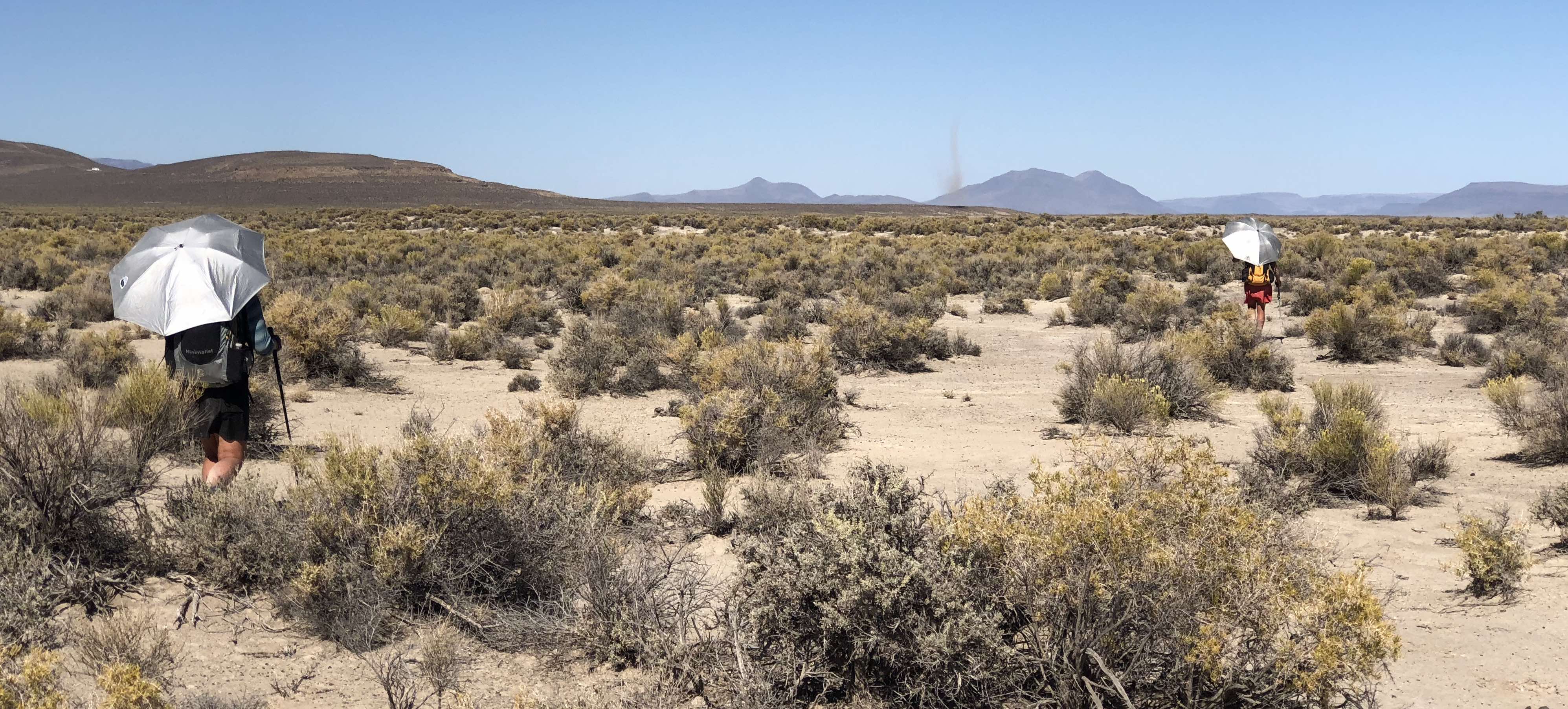
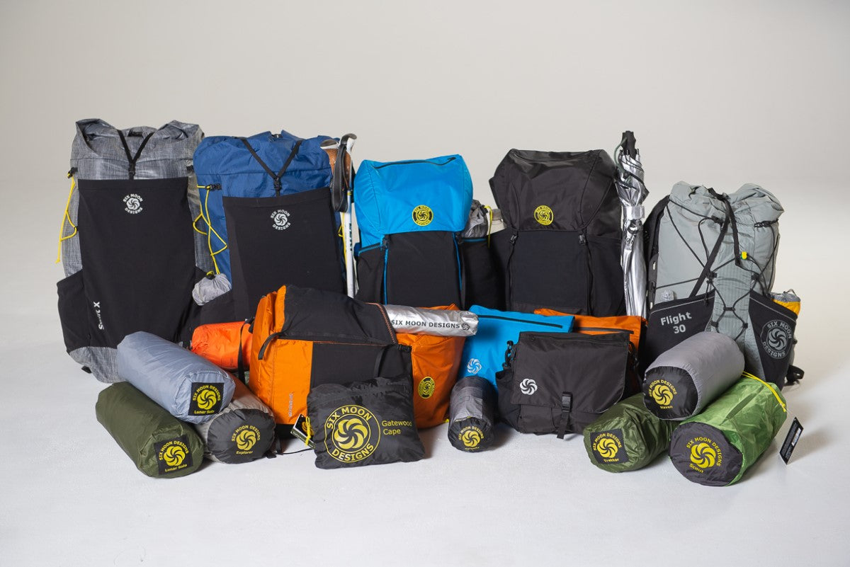
It rained almost continuously during this time but I stayed dry and comfortable using the SMD Rainwalker umbrella with the hands free clips. I use hiking poles that also support the Skyscape Trekker shelter which I’ve found to be very sturdy and reliable in bad weather. When I tried to regain the CDT by following the cairns, dense fog moved in and I couldn’t see or find the next cairn. All I could do was head west using my compass and hope to find the trail. When the fog lifted I couldn’t find a single cairn but continued zig zagging northwest until finally locating the CDT then continuing north through steady rain and low hanging clouds. I reached the trail to Green Lake and hiked off the divide to camp. The lake has good fishing but it was late, raining and cold and I was exhausted so I set the tent and hopped inside.
The next morning after catching and releasing a couple trout I hiked back to the CDT and met a thru hiker “Shutterbug” drying gear on a large rock. We would “leap-frog” each other over the next few days. As I passed Blue Lake, I spied some trout frolicking along the shore so I decided to combine a lunch break with some fishing. I caught and released a ten inch cutthroat trout before continuing up the trail “one and done” or “finish on a fish”.

The rest of the afternoon was partly cloudy but nasty dark clouds gathered as I made camp above the treeline and just after dinner the storm hit with heavy winds and hail. The ground turned white and so much hail accumulated on my tent I had to shake it off periodically and the wind would distort the shelter into unusual shapes. It continued for a couple of hours but I was snug and dry and was finally able to get some sleep.

The next two days I managed to stay ahead of the storm clouds and make big miles until north of Elwood pass where I was slowed by large sections of blown down trees blocking the trail. It was hard and slow work climbing over and around these obstacles piled up dead trees killed by the Pine Beetle infestation a few years ago and now that are starting to fall over. My last campsite before town resupply was a clearing behind the Wolf Creek ski area and while setting up I’m visited by an overly friendly fox. Shutterbug hikes in and sets up nearby and she gets a visit too. As I’m making dinner the fox comes by again but this time grabs one of my shoes and takes off. I yelled and scrambled out of the tent and luckily it dropped the shoe about 20 yards away. This has never happened before and scared of the thought of hiking with one shoe, I bring my shoes inside for the night, relieved that there is no sign of the fox again. The next day I meet Deb and we head into Pagosa Springs for resupply and a day off. Yes, it rains when we’re in town.

I picked up the CDT northbound again on July 2 and headed into the Weminuche Wilderness on a partly cloudy day. At the (hard to find) side trail to Spruce Lakes, I hike in and find good fishing. Dark clouds started brewing so I returned to the trail and sure enough I’m hit with more rain. During the monsoon it will often be clear and sunny in the morning but then small groups of white clouds will appear, join up and become darker. Above the treeline it is easy to see this developing and there is time to prepare by putting on my rainsuit and attaching the hands free umbrella to my pack. I use the lightweight SMD pack liner so everything inside stays dry. These downpours typically start with thunder in the distance and you can see it’s approach then lightning with rain and hail will erupt and can be quite intense. If it’s earlier in the day I may deploy my shelter and ride it out, often within the hour I’m back on the trail. If not and the lightning is close, I'll keep an eye out for a place to hunker down in lower trees or rocks but if the wind gets too high, I’ve got to hold on to the umbrella. Once, high winds caught me and spun me around as the umbrella inverted, I spun around back into the wind and the umbrella popped back into shape with no damage. The 5.5 oz Rainwalker is rugged!

I reached Squaw Pass on the CDT and took the Squaw Creek trail (in the rain) down to the Rio Grande Reservoir where I met the GoHawkeye crew for the annual “Fish Camp''. They had circled the “wagons'' in a dispersed camping area for a couple of days of food, fun and great fishing with surprisingly clear skies although it did rain one evening. Deb showed up with my SMD Flex rafting backpack, 3.8 lb. Alpaca Scout raft, 4 pc. paddle and pfd for the next leg of the hike and I was joined by my friend Tony. I switched out to a lighter shelter, the SMD Deschutes Bundle, a tarp with interior Serenity bug net. We took the Ute Creek trail up to West Ute Lake on the CDT, camped and fished along the way. Of course the constantly changing weather continued but we had fun with the raft, great fishing and tasty trout. Back at the reservoir, I switched back to the Skyscape Trekker and my old Fusion 65 pack. Thanks to the GoHawkeye crew it was nice to have these options. Tony joined me on the Lost trail up to Heart Lake and some rainy camping and slow fishing. I left him here and bushwhacked to a jeep trail that took me to Carson pass and I rejoined the CDT northbound.

I resupplied in Lake City after hitching in from Spring Creek Pass and was able to take advantage of the Sunday free hiker feed sponsored by the local churches of the community. This was a Thanksgiving style Turkey/pot luck dinner, well attended by the community and they made hikers go to the front of the line with an announcement and a big cheer! I met lots of nice townspeople and other hikers and scored a ride back to the pass on July 18. I hiked north north across Snow Mesa then steep up and down to San Luis Pass and the LaGarita Wilderness with the wet weather. I noticed the animals were starting to pair up and wondered how long this monsoon can last. Long distance hiking requires being able to adapt and make changes. It’s been hard and slow hiking and at Eddiesville trailhead I stopped and calculated the miles and time that remained for my hike. My original goal to reach Monarch Pass/Salida before turning around meant too many miles remained and not enough time. I needed to be back in Telluride at the beginning of August to leave for a month-long road trip to Maine so the next day, I turned around and headed back south on the CDT.

Even though the terrain was familiar, It didn't get any easier and after resupplying again in Lake City I continued south with the crazy monsoon weather that was going to extend into late August. I left the CDT at the Highland Mary Lakes trail and enjoyed some fishing at Verde Lake and Lost lake. I continued on the Whitehead trail to the Kendall Mountain jeep trail and on into Silverton where I stayed with friends John and Samantha overnight. After breakfast, I went on to Niagara Gulch then bushwhacked under Ohio Peak and down crossing Mineral Creek and then up the Columbine Lake trail…in the rain of course but still no sign of the ark. I camped at Columbine Lake then bushwhacked over the ridge to Bridal Veil Basin. I found the Wasatch trail through fields of still fresh wildflowers then down the Bear Creek trail to Telluride and home on July 29.

So instead of the original plan of 40 days and 450 miles, this hike lasted 36 days and 350 miles. I felt reconnected to the rhythm of nature which is something we all need especially those living with a disability. Even with all the rain and though I was tired with sore feet, damp and smelly, I felt empowered and grateful to use this hike to raise money for adaptive athletes, to help purchase equipment and experiences for outdoor adventures through generous donations to the GoHawkeye Foundation. I’m looking forward to what future trails have in store for me and the people we help, but hopefully without so much rain.



Leave a comment
This site is protected by hCaptcha and the hCaptcha Privacy Policy and Terms of Service apply.